


Crow Voting District, King County, Washington
About
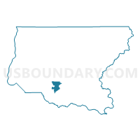
Outline

Summary
| Unique Area Identifier | 686970 |
| Name | Crow Voting District |
| County | King County |
| State | Washington |
| Area (square miles) | 15.04 |
| Land Area (square miles) | 14.65 |
| Water Area (square miles) | 0.39 |
| % of Land Area | 97.40 |
| % of Water Area | 2.60 |
| Latitude of the Internal Point | 47.31390830 |
| Longtitude of the Internal Point | -121.96710010 |
Maps


Graphs
Select a template below for downloading or customizing gragh for Crow Voting District, King County, Washington


Neighbors
Neighoring Voting District (by Name) Neighboring Voting District on the Map
- B-D 05-0239 Voting District, King County, WA
- B-D 47-0240 Voting District, King County, WA
- B-D 47-3310 Voting District, King County, WA
- Cumberland Voting District, King County, WA
- Farley Voting District, King County, WA
- Green River Voting District, King County, WA
- Krain Voting District, King County, WA
- Lake Retreat Voting District, King County, WA
- M-V 05-3367 Voting District, King County, WA
- Maple Ridge Voting District, King County, WA
- Neuwaukum Voting District, King County, WA
- Phoebe Voting District, King County, WA
- Ravensdale Voting District, King County, WA
- Veazie Voting District, King County, WA
Top 10 Neighboring County Subdivision (by Population) Neighboring County Subdivision on the Map
Top 10 Neighboring Place (by Population) Neighboring Place on the Map
Top 10 Neighboring Unified School District (by Population) Neighboring Unified School District on the Map
- Auburn School District, WA (84,053)
- Tahoma School District, WA (37,376)
- Enumclaw School District, WA (25,179)
Top 10 Neighboring State Legislative District Lower Chamber (by Population) Neighboring State Legislative District Lower Chamber on the Map
- State House District 5, WA (161,403)
- State House District 47, WA (140,146)
- State House District 31, WA (137,685)
Top 10 Neighboring State Legislative District Upper Chamber (by Population) Neighboring State Legislative District Upper Chamber on the Map
- State Senate District 5, WA (161,403)
- State Senate District 47, WA (140,146)
- State Senate District 31, WA (137,685)
Top 10 Neighboring 111th Congressional District (by Population) Neighboring 111th Congressional District on the Map
Top 10 Neighboring Census Tract (by Population) Neighboring Census Tract on the Map
- Census Tract 312.02, King County, WA (6,401)
- Census Tract 316.03, King County, WA (5,728)
- Census Tract 316.04, King County, WA (4,797)
- Census Tract 315.01, King County, WA (3,616)
- Census Tract 316.05, King County, WA (3,589)